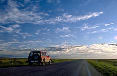
|
| The road between Hay and
Balranald |
Balranald (including Kyalite, Tooleybuc, Koraleigh,
Penarie, Hatfield and Oxley)
Attractive service town on the banks of Murrumbidgee
River
Balranald is situated on a flat saltbush and mallee plain by
the Murrumbidgee River, 859 km west of Sydney via the Great
Western, Mid Western and Sturt Highways. It is 60 m above
sea-level it has a population of 1327 people. Balranald is a
service centre for the surrounding irrigation district
which, in recent times, has expanded from conventional
agriculture to viticulture, horticulture and tourism.
Considered the oldest settlement on the lower part of the
Murrumbidgee the area was once occupied by, amongst others,
the Wemba-Wemba Aborigines, who called the area 'Nap Nap'.
European settlement decimated the local community who were
eventually removed to a 142-acre reserve at the western end
of the town.
In 1817 John Oxley, trying to follow the recently
discovered Lachlan River, got to within 23 km of its
intersection with the Murrumbidgee but was prevented by an
impassable sea of 5-metre high reeds in the Great Cumbungi
Swamp. He concluded that 'the interior of this vast
continent is a marsh and uninhabitable'.
In January 1830 explorer Charles Sturt and his party
rowed through the intersection of the Lachlan and
Murrumbidgee Rivers in a whaleboat which took them past the
future townsite of Balranald. They camped nearby and then
continued to the river's mouth at Lake Alexandria in South
Australia.
Six years later Thomas Mitchell, also investigating the
river system, camped at the site of the future township.
Accompanying his party was an Aboriginal guide Yuranigh who
preferred to be called John Piper. Two local streets (Yuranigh
and Piper) have been named in his honour.
Mitchell's account of the lands he found excited interest
among the squatters. The first runs were taken up along the
river front in the early 1840s. The first on the land now
associated with Balranald was taken up and occupied by
George Hobler in 1845. The townsite was first used by
Europeans as a river crossing. Peddlers, shepherds and
itinerants stayed there, setting up some form of primitive
and temporary shelter.
The first store appeared in 1848. A hotel, the Balranald
Inn, quickly followed (also 1848). The site was visited that
same year by the first commissioner for crown lands of the
Lower Darling, George James MacDonald, who named it
Balranald after his birthplace in the Outer Hebrides. The
word means village of the Ranalds, a branch of the MacDonald
clan.
MacDonald laid aside large reserves in the expectation
that the future township would become an important river
port. A post office opened and the first district constable
was appointed in 1850. The site was laid out and gazetted in
1851.
In a contemporary Sydney Morning Herald article (1858)
Balranald was described as: 'This obscure and miserable
township situated on the Lower Murrumbidgee is here
attracting a considerable share of attention as being one of
those rowdy places for which the Australian bush in the
interior has become so famous'.
The first punt was set up in 1859, the year the first
Cobb & Co. coaches arrived. As a major river crossing
Balranald prospered.
Burke and Wills crossed the Murrumbidgee via the Mayall
St punt and camped on the riverbank in front of the
Balranald Inn in September 1860.
The population of Balranald doubled between 1865, when
the first National School was opened, and 1873, when it
reached 350. A bridge across the Murrumbidgee was built in
1880 and the township was declared a municipality in 1882.
The railway arrived in 1926.
|
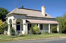
| The Old Bank now a
private home |
Today Balranald has little for the visitor to see.
Virtually all the historic remains can be found at Heritage
Park in Market St. There you will find the old gaol and
school house, along with the visitor's centre and an
historical museum which is open Wednesdays from 2.00 pm -
4.00 pm or other times by appointment, tel: (03) 5020 1599.
On the corner of Court and Mayall Streets is the charming
old bank building, now a private home.
The grave of Josiah Viles is located in the Church of
England section of the Balranald Cemetery which is
signposted from the main street. Viles was an eccentric and
much loved town crier who used to carry a rifle which he
fired when there was an important announcement. He died in
1925.
Greenham Park has a swimming pool, showers, toilets and a
recreation/sports ground. There are picnic, barbecue and
playground facilities at Lions Park in Market St.
Things to see:
![[Top of page]](../../companyweb/smlArrow.gif)
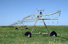
|
| Irrigation equipment in
the MIA between Hay and Balranald
|
Yanga Lake
8 km south-east on the Sturt Hwy, near the Waugorah Rd
turnoff is a good location for fishing and aquatic
activities. Yanga Homestead is said to be largest freehold
property in the southern hemisphere. One of the first
telephones in Australia connected the homestead with the
men's quarters. It was installed by Alexander Graham Bell's
nephew.
Kyalite
36 km south is the tiny village of Kyalite, situated on the
banks of the Wakool River. It was founded by Henry Talbett
who established a punt service across the river in 1848
which was used by Burke and Wills in 1860. Talbett soon
added an inn and a general store. Today there are only about
thirty people although it contains Australia's largest
commercial pistachio nut farm. The Kyalite Hotel was
established in 1858 and has been faithfully restored,
complete with pressed iron walls. A caravan park is attached
to the pub while the general store cum BYO restaurant sells
local souvenirs and Aboriginal craftwork. It is a very
popular area with campers, fishers and shooters. Kyalite
State Forest begins 10 km east along the Moulamein Road. It
covers 577 ha and envelopes the Wakool River and a plenitude
of wildlife.
Tooleybuc
18 km south-west of Kyalite is Tooleybuc, a tiny and
tranquil settlement with a village atmosphere and a large
sporting club which serves drinks and meals. It is located
right on the state border by the banks of the Murray River.
Tooleybuc is a pleasant spot for picnicking and riverside
walks. Fishing is especially popular and there is a boat
ramp.
In the warmer months you can take an informal ride on a
barge along the Murray River. There is no set fee although a
donation will be greatly appreciated as it will go to the
Red Cross. You can cook up a barbecue on board, fish or just
relax and enjoy the scenery, tel: (03 ) 5030 5025.
Ring Tree
If you follow the Koraleigh Rd which heads south out of town
then, about halfway to Koraleigh, a roadside sign warns you
that you are about to come to the Ring Tree. A remnant of
pre-colonial days, it is a very rare surviving example of an
old Aboriginal boundary marker. Notice that the branches
have been tied together so they grow in the shape of a ring.
Situated on the right-hand side of the road it is a large
tree which stands alone about 10 metres off the road. There
are plans to erect a cairn with an explanatory plaque.
Koraleigh Country Collection
If you continue along the Koraleigh Rd you will come to
Eagles Lane, a side-road on the left with a signpost
alerting you that this is the turnoff to Koraleigh Country
Collection which is to be found about 2 km along the road.
It consists of a heritage display in a rural parkland
setting, featuring horse-drawn machinery and other artefacts
and memorabilia of the pre-tractor dried-fruit era
(1910-40). There is a nursery, a cactus garden, a craft shop
and plenty of birds wandering about.
The principal opening hours are Sundays from 1.00 p.m. to
5.00 p.m. and on Monday and Tuesday from 10.00 a.m. to 5.00
p.m., although other times can be organised by appointment,
tel: (03) 5030 2141. During the Victorian school holidays,
the business is also open on Wednesdays and Thursdays from
10.00 a.m. to 5.00 p.m. The business is well set up for
coach tours.
If you return to the Koraleigh Rd and follow it south for
another 2 km you will reach a T-intersection. Turn right and
it is just 2 km to Nyah on the Murray Valley Highway.
Attractions just over the border are Tyntynder homestead,
Buller's Winery and The Pheasant Farm (see entry on
Swan Hill).
Low Level Weir
6 km west of Balranald on the Sturt Highway is Low Level
Weir, another pleasant spot for picnics, barbecues or
fishing.
Penarie
32 km north of Balranald on the Ivanhoe Road is Penarie
which has little other than the Homebush Hotel (c.1870) and
a camping ground, although there is other accommodation.
When Burke and Wills passed the site in 1860 there were
already some signs of settlement. Michael Dowdican applied
for land in 1877 and opened the hotel the following year.
Hatfield
70 km along the Ivanhoe Road, amidst flat saltbush plains
and red sandy ridges is Hatfield. It was here in 1879 that a
band of four horse thieves began a very short-lived spree of
bushranging when they robbed the hotelier. They were caught
after a shootout two days later and subsequently executed.
A branch road which departs westwards from the Ivanhoe
Road 58 km north of Balranald will take you on, via Bidura,
to Australia's most famous anthropological site,
Lake Mungo, where there is Aboriginal material dating
back 40 000 years.
At Penarie another road branches north-east towards
Oxley. Along this road is Redbank Weir, 58 km from Balranald
with barbecues, picnic facilities and toilets. The
intersection of the Murrumbidgee and Lachlan by the Great
Cumbungi Swamp and the swamp itself are excellent fishing
spots.
Balranald Island
Balranald Island, a few kilometres east of town, is an
island in the Murrumbidgee. Measuring approximately 5 km it
is considered a significant site by the Madi Madi people as
it was the burial place of Jimmy Morris, their last
Nguloongurra man (clever man). It is said his great
knowledge of the local land and fauna gave him great power.
There is no public access.
Hells Gate
50 km east of Balranald is the property knows as Hell's
Gate. It is on a dead flat stretch of the Riverina. This was
the 'Hell', or so the rumour goes, which 'Banjo' Paterson
referred to when he wrote of 'Hay, Hell and Booligal'.

Broadwalk
Business Brokers
Broadwalk Business
Brokers specialise in General Businesses for Sale, Caravan Parks for
Sale, Motels for Sale, Management Rights & Resorts for Sale, Farms for
Sale, Hotels for sale,Commercial & Industrial Properties for Sale.
Phone:
1300 136 559
Email:
enquiries@broadwalkbusinessbrokers.com.au
AUSTRALIAN BUSINESSES FOR SALE
COFFS HARBOUR BUSINESS BROKERS
BROADWALK BUSINESS BROKERS
GOLD COAST BUSINESSES FOR SALE
BRISBANE BUSINESSES FOR SALE
SYDNEY BUSINESSES FOR SALE
CARAVAN PARKS FOR SALE
BUSINESSES FOR SALE
MOTELS
FOR SALE
HOTELS
FOR SALE
Disclaimer
We advise prospective purchasers that we take no
responsibility for the accuracy of any information in the business
provided by vendors or their professional advisers and that they should
make their own enquiries as to the accuracy of this information,
including obtaining independent legal and/or accounting advice
Balranald